
Metals And Mining Review

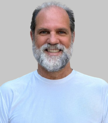 Renato Cordani, Founder and Managing Partner
For Renato Cordani, founder and managing partner of Reconsult Geofísica , data is only the beginning. A geophysicist with 33 years of experience, including Rio Tinto Exploration, he knows that drilling decisions depend on how data was acquired, how it was processed, which method suits the deposit type and whether the signal aligns with the geology.
That judgment has shaped Reconsult since 1995. The company began in field acquisition, with Cordani leading survey teams and later expanded into airborne data processing, learning how geophysical data behaves before it is modeled. Over time, that discipline, combined with decades of Brazilian geological experience, became Reconsult’s defining capability— interpreting geophysical responses within their geological context.
This matters most when clients bring uncertain targets. Reconsult does more than read magnetic, gravity or electromagnetic anomalies. It evaluates whether those responses fit the expected mineral system, compares them with similar deposits across Brazil and identifies when a method is unlikely to succeed. The result is clearer guidance and stronger drill hole decisions.
“Brazil is a vast country and a deep understanding of its local geology and known metallogenic processes is fundamental to discovering new deposits,” says Cordani. “When a client’s area shares a geological context with deposits we know, our experience helps us find the right geophysical solutions faster. The final product of my interpretation is the location of drill holes.”
In 2021, the Brazilian Geophysical Society named him the country’s best geophysicist for mineral exploration.
From Anomaly to Drill Hole
Reconsult’s preferred workflow begins before acquisition. The team helps select the method, design the survey, oversee quality control, process the data, build models, interpret results and recommend drill hole locations. When clients already have data, Reconsult works from that evidence, but the strongest outcomes occur when geologists and geophysicists can jointly evaluate the geological context in 3D.
-
When a client’s area shares a geological context with deposits we know, our experience helps us find the right geophysical solutions faster. The final product of my interpretation is the location of drill holes.
Many clients lack in house geophysical expertise. They may have surface geology or geochemistry, but those datasets are often 2D. Reconsult’s role is to bring all evidence—drill holes, geology, geochemistry and geophysical models— into a single 3D environment to determine whether a subsurface body merits drilling.
Gold Lies in the Details
Gold exploration has been Reconsult’s main focus for the past six years. Gold rarely produces a diagnostic geophysical response, so success depends on detailed structural interpretation and careful integration of multiple datasets.
Reconsult has applied this approach across mineral systems, identifying nickel from blind magnetic sources in Tocantins, mapping carbonatite signatures within alkaline complexes in São Paulo, Minas Gerais and Goiás, locating primary diamond sources in Bahia and expanding gold targets through structural interpretation of airborne surveys in Pará and Goiás.
Drone geophysics has sharpened these results. Lower sensor altitude enables line spacing of 50 meters or less, far tighter than the 200 meter standard of older surveys, delivering higher resolution for new prospecting projects. Faster computing allows inversions that once required days to be refined in hours, reducing ambiguity before recommendations reach the client.
A Brazil Honed Capability
Reconsult’s expertise also extends beyond Brazil. Cordani has worked with governments in Colombia, Congo Brazzaville, Angola and Sierra Leone to strengthen geophysical capabilities in countries building exploration standards. This reflects one of Reconsult’s broader contributions: applying decades of Brazilian prospecting knowledge to markets seeking higher quality geophysics.
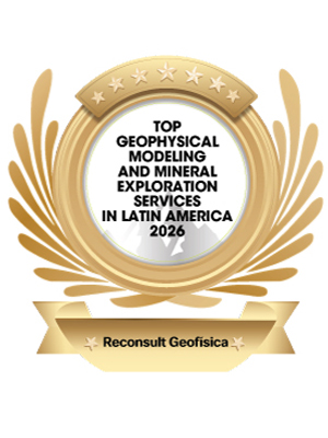
Metals and Mining Review named Reconsult the Top Geophysical Modeling and Mineral Exploration Services in Latin America 2026, recognizing its practical value: helping clients move from raw data to geological understanding and better placed drill holes.
Reducing Drill Risk through Stronger Subsurface Models
Budgets for exploration can quickly run out while actual uncertainty persists. Even with a concession's extensive surface mapping, dispersed geochemistry, outdated geophysical data, and a few old drill holes, one question remains unresolved: where is the ore body located at depth? The value of geophysics does not lie in providing additional data for executives financing mineral exploration. It is in making the existing evidence clear enough to support the next drilling decision. The question is whether interpretation can narrow drill choices before capital is spent on meters that do little more than confirm ambiguity.
Good geophysical work now depends on turning measured fields into usable subsurface models. Magnetic and gravity responses still matter, but their value comes from disciplined inversion and geological constraints that can survive contact with drilling plans. Buyers should be wary of reports that stop at colored maps or loosely ranked targets. The stronger service model uses a 3D working environment to relate survey data to known structures, then turns that reading into recommendations a geology team can challenge and act on.
This shift is especially important in deposits where the target does not announce itself cleanly. Gold systems, for example, often demand structural reading at a finer scale than bulk signatures can provide. Drone acquisition has changed that work by delivering tighter line spacing and lower flight altitudes, yet better data does not automatically create better targets. It can simply reveal more detail than a weak interpretation process can manage. The useful partner is the one that can decide which details matter and which are survey noise, processing artifacts, legacy assumptions and attractive distractions.
Integration remains a common failure point. Surface geology may describe the map well while saying too little about depth. Geochemistry can point to dispersion patterns without resolving the body that produced them. Existing drill holes may be valuable but spatially thin. A strong consulting engagement translates these fragments into a shared 3D view rather than leaving each discipline in its own file set. That matters because the final decision is rarely about a perfect model. It is about whether the next hole is more likely to test the right volume.
Technology selection should be judged by what it changes in the exploration workflow. Faster modeling can allow multiple iterations during interpretation rather than a single late-stage pass. Better inversion software can support comparison between alternative geological readings. Quality control during acquisition can prevent flawed inputs from becoming expensive speculation later. The commercial test is plain. The consultant should reduce wasted drilling while giving technical teams a clearer argument for the next budget request.
Reconsult Geofísica emerges as a premier choice for buyers seeking geophysical modeling directly tied to mineral exploration decisions. Its relevant work centers on the interpretation and modeling of geophysical surveys, including magnetic and gravity surveys, from acquisition quality control through processing. The company’s approach is strengthened by deep familiarity with Brazilian geology and advanced inversion software, both of which are applied to convert 2D geological inputs into 3D subsurface models. Its most practical distinction is the end product. Reconsult’s reports are built around drill-hole locations, providing buyers with a service that connects modeling work to capital allocation in the field.
...Read more
Geophysical Modeling and Mineral Exploration Services in Latin America Info
Q1
What Do Geophysical Modeling and Mineral Exploration Services in Latin America Include?
Geophysical Modeling and Mineral Exploration Services in Latin America help exploration teams turn field measurements into subsurface understanding. The work can include magnetic and gravity data acquisition, processing, quality control, interpretation, inversion and geological modeling. These services support decisions when visible surface deposits are limited and exploration programs need a clearer view of buried mineralized bodies. They also help organize technical evidence before drilling, budgeting or reassessing a target area.
Q2
How Does Reconsult Geofísica Support Modern Exploration Programs?
Reconsult Geofísica supports Geophysical Modeling and Mineral Exploration Services in Latin America through applied geophysics, interpretation and modeling of survey data. Based in São Paulo, the company has more than 15 years of experience across mineral, oil and gas exploration. Its work includes magnetic and gravity methods, data processing, acquisition quality control and geophysical interpretation for exploration decisions. That combination positions the company around the practical task of making geophysical information usable for multidisciplinary exploration teams.
Q3
Why Is Inversion Important in Exploration Modeling?
Inversion is important because it helps convert measured anomalies into estimates of depth, location, geometry and physical property distribution. In Geophysical Modeling and Mineral Exploration Services in Latin America, inversion gives geologists and project teams a more usable view of potential targets, especially where deposits are concealed or where drilling decisions need stronger technical support. It can reduce uncertainty by showing whether a response is likely to be shallow, deep, continuous or structurally controlled.
Q4
What Technical Capabilities Matter in Geophysical Interpretation?
Useful interpretation depends on reliable survey inputs, disciplined processing and tools that can test subsurface possibilities in two and three dimensions. Geophysical Modeling and Mineral Exploration Services in Latin America may involve gravity, magnetic, electromagnetic, induced polarization and resistivity data. Strong providers also integrate results with geological, geochemical and historical drilling information rather than treating datasets in isolation. The goal is not only to produce images, but to translate those images into defensible exploration guidance.
Q5
How Can Exploration Teams Evaluate Modeling Partners?
Exploration teams should look for modeling partners that combine field-method knowledge with interpretation software, quality control experience and clear geological communication. For Geophysical Modeling and Mineral Exploration Services in Latin America, value comes from turning complex geophysical images into practical target information that non-specialists can understand and technical teams can challenge before committing additional capital. A partner should explain assumptions, show uncertainty and connect results to next-step decisions instead of presenting models as final answers.
Q6
What Makes Reconsult Geofísica Relevant to This Category?
Reconsult Geofísica is relevant to Geophysical Modeling and Mineral Exploration Services in Latin America because it works across multiple geophysical methods and modeling environments. Its team uses platforms such as Oasis Montaj, ModelVision Pro, UBC-GIF and Maxwell for gravity, magnetic and electromagnetic interpretation. The company also connects modeling outputs with exploration planning by emphasizing training, inversion capability and geological translation. Its published technical orientation around EM, gravity, magnetic, IP and resistivity interpretation reflects the breadth expected in this category.
Company
Reconsult Geofísica
Management
Renato Cordani, Founder and Managing Partner
Description
Reconsult Geofísica provides geophysical modeling and mineral exploration services that help clients turn geological, geochemical and airborne data into stronger drill-hole decisions. With Brazil-honed expertise, it integrates acquisition, processing, 3D interpretation and deposit knowledge to reduce uncertainty before drilling begins.